Looking at the map below the small distance that separates the island of Samos from Turkey, a mere 1.65 km at its closest distance (less than one mile), becomes quite obvious! Thus, the casual onlooker would assume that this is the route that most refugees will take with their boats. To be sure, some refugees have taken the route successfully but anyone who has sailed the area will caution against doing so. It so happens that most refugees appeared at the coasts where the red X's are located. This post is to explain why this is so.

First of all, the green patch on the Turkish side close to Samos is a nature preserve and probably guarded. Of course, this wouldn't deter determined refugees and their smugglers but it would make the job somewhat harder because smuggling people over borders is also illegal in Turkey.
Most important for movement on water with small motors or, worse, non-functioning motors, are the prevailing winds and sea currents.
Sea currents in the Aegean sea are quite complex, a consequence of its highly irregular coastline, complex archepelago and a bottom topography that shows alternating shelves and sills as well as three major semi-isolated deep basins. Like other marginal seas (e.g. the Caribbean) it combines wind-driven and thermohaline-driven flows as well as eddies. The complicated topography is probably best seen on the following map:
The Aegean Sea is subdivided into various seas; of interest for our purposes is the Ikario Sea which is located between the islands of Chios in the north and Kos in the south.

Conclusion:
Currents: Taking all these pieces of information together, one can come to the following conclusion: there is a deep basin (the geologic graben) west of Samos and north of Ikaria which will most likely cause the water current to alter its usual northward course. Since the water column is different from the surrounding ones, e.g. denser at the bottom of the basin, eddies are created. North of the western half of the island water reaches to depths up to 1,000 m, decreasing towards the east on the shelf. Usually, the current will flow from the south towards the north but the islands' landmass perpendicular to the wave action will direct the flow through the available channels causing jet-like surges. This is why crossing from the closest point in Turkey to Samos is not advisable; sailboats have often failed in rounding the island here.
Winds: Generally, the prevailing winds on Samos come from the N or NW with strengths of between 2-3 on the Beaufort scale, Meltemi events have greater strengths. Thus the current will be directed towards the south. I have included a chart to the right which reports today's (June 8, 2016) wind and wave direction. At this point we are experiencing a rather strong Meltemi event and today marks the 3rd day of relatively cool temperatures and high waves during the day. If one compares the wind directions which, for the most part point to the south and the wave direction, one can see some correlations but also some discrepancies.
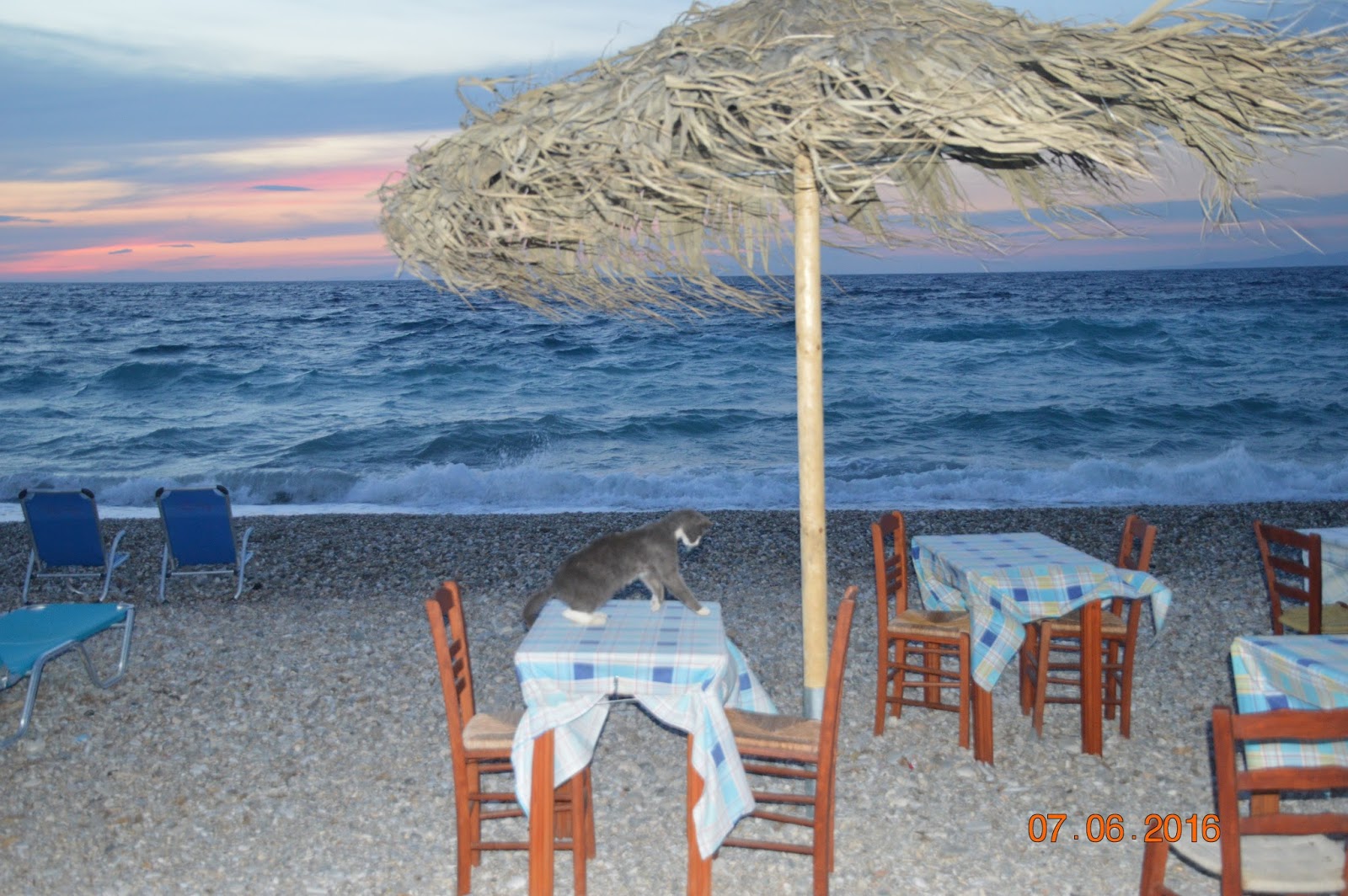
Below two photos taken to document the Meltemi wind at a high Beaufort strenth (6 and stronger) and a local domesticated animal enjoying the empty table top.


First of all, the green patch on the Turkish side close to Samos is a nature preserve and probably guarded. Of course, this wouldn't deter determined refugees and their smugglers but it would make the job somewhat harder because smuggling people over borders is also illegal in Turkey.
Most important for movement on water with small motors or, worse, non-functioning motors, are the prevailing winds and sea currents.
Sea currents in the Aegean sea are quite complex, a consequence of its highly irregular coastline, complex archepelago and a bottom topography that shows alternating shelves and sills as well as three major semi-isolated deep basins. Like other marginal seas (e.g. the Caribbean) it combines wind-driven and thermohaline-driven flows as well as eddies. The complicated topography is probably best seen on the following map:
 |
| This map shows the bottom topography of the area--deep basins prevail to the west and generally shallower platform topography is located in the eastern portion of the Aegean Sea. The red arrows show the general circulation. Source: DONALD B. OLSON, VASSILIKI H. KOURAFALOU, WILLIAM E. JOHNS, GEOFF SAMUELS, AND MILENA VENEZIANI (2006). Aegean Surface Circulation from a Satellite-Tracked Drifter Array. JOURNAL OF PHYSICAL OCEANOGRAPHY, Vol. 37. pp. 1898-1917. Retrieved at http://journals.ametsoc.org/doi/pdf/10.1175/JPO3028.1 . |

The surface circulation is influenced mainly by the annual summer winds and the low surge of salinity arriving from the Black Sea via the Sea of Marmara and the Dardanelles Strait in the north -see map above for location of the Dardanelles Strait and below for surface flow. Here, the incoming waters hold less salinity than those of the Mediterranean Sea so that the cooler water is on top while warmer but saltier and thus denser water from the Mediterranean Sea enters the Dardanelles underneath this layer.
 |
| Surface currents of the Mediterranean Sea in June |
The currents map above clearly shows the cooler water coming from the Dardanelles and the warmer, highly saline water entering the Aegean Sea from the southeast, from Asia Minor. The usually stagnant, deep basins of the Aegean Sea hold highly dense waters which could exchange water through density currents under the right conditions. Overall, the Aegean Sea can be compared to an estuarine basin due to the Dardanelles outflow and the significant annual changes in the thermohaline circulation, even reversals (winter vs summer), of dense water formation.
 |
| Major seasonal winds Affecting the Mediterranean Sea Retrieved from: http://www.mediterranean-yachting.com/winds.htm |
Much of the general current circulation is wind-dependent so a short excursion into the winds influencing the Mediterranean Sea is warranted. The winds prevalent in the eastern Aegean Sea is the Meltemi, a Turkish name that has replaced the Greek term Etesian. Regardless of its name, the wind has its source in the prevalent high (H) and low pressure (T) zones over the Greek and Turkish mainlands, respectively.
 |
| Source: http://www.esys.org/wetter/meltemi.html |
The Meltemi usually occurs in the summer months on an irregular basis and is controlled by the SouthAsian monsoon and a local diurnal cycle. The Balkan High (H) is triggered by disturbances from the Atlantic Ocean inducing strong northerly flow on its way to the Low (T). The Turkish Low comes into existence due to sensible heat accumulating on the Anatolian Plateau which heats up further as the day advances, in turn strengthening the resultant Meltemi winds. At night the Low lessens because of the cooling effect and so do the Meltemi winds.
 |
| Wind chart from 17 Juli 2012 showing the strength of the Meltemi in the Aegean Sea. Note that the area north of Samos is relatively calm at F5. |
 |
| Bottom topography of the Ikarian Sea north of Samos |
Currents: Taking all these pieces of information together, one can come to the following conclusion: there is a deep basin (the geologic graben) west of Samos and north of Ikaria which will most likely cause the water current to alter its usual northward course. Since the water column is different from the surrounding ones, e.g. denser at the bottom of the basin, eddies are created. North of the western half of the island water reaches to depths up to 1,000 m, decreasing towards the east on the shelf. Usually, the current will flow from the south towards the north but the islands' landmass perpendicular to the wave action will direct the flow through the available channels causing jet-like surges. This is why crossing from the closest point in Turkey to Samos is not advisable; sailboats have often failed in rounding the island here.
Winds: Generally, the prevailing winds on Samos come from the N or NW with strengths of between 2-3 on the Beaufort scale, Meltemi events have greater strengths. Thus the current will be directed towards the south. I have included a chart to the right which reports today's (June 8, 2016) wind and wave direction. At this point we are experiencing a rather strong Meltemi event and today marks the 3rd day of relatively cool temperatures and high waves during the day. If one compares the wind directions which, for the most part point to the south and the wave direction, one can see some correlations but also some discrepancies.
 |
| Wind and wave direction courtesy of windfinder.com. |
Below two photos taken to document the Meltemi wind at a high Beaufort strenth (6 and stronger) and a local domesticated animal enjoying the empty table top.

 |
| Samos Airport: Windfinder. https://www.windfinder.com/ windstatistics/samos |
Meltemi events are often followed by Sirocco events which are strong dust-bearing winds blowing from the south, the Sahara area. Apart from the fact that people feel sluggish with this very hot wind, lots of dust and small silt particles are deposited everywhere, best visible on dark cars (see photo below). All in all, southern winds are less frequent (see graph) but not uncommon. These winds will cause rather high waves and may also reverse the currents in the Golf of Kusadasi.
 |
| Sahara dust after Sirocco and rains |
----------------
Sources:
Ingemi, D (2012). Con ''ingresso dell'anticiclone oceanico si scatenano i venti "Etesii" tra la Grecia e l'Egeo, previste raffiche fina a 60 km/h. Retrieved from: http://www.meteoweb.eu/2012/07/con-lingress-dellanticilone-oceanico-si-scatenano-i-venti-etesii-tra-la-grecia-e-legeo-previste-raffiche-fino-a-60-kmh/144237/#XPzVf2dkfh2otzLf.99
DONALD B. OLSON, VASSILIKI H. KOURAFALOU, WILLIAM E. JOHNS, GEOFF SAMUELS, AND MILENA VENEZIANI (2006). Aegean Surface Circulation from a Satellite-Tracked Drifter Array. JOURNAL OF PHYSICAL OCEANOGRAPHY, Vol. 37. pp. 1898-1917. Retrieved at http://journals.ametsoc.org/doi/pdf/10.1175/JPO3028.1
Valiakos, Ilias (2007). Oceanography of the Aegean. Encyclopaedia of the Hellenic World, Asia Minor. Retrieved from http://www.ehw.gr/l.aspx?id=10540
Vassilopoulos A., Evelpidou N., Tziritis E., Boglis A.
(2006-2008). ManWater: Management of Water Resources and Wetland Protection in
Tourism Developing Areas. Wetlands—the Example of Samos Island. INTERREG III –
Strand B – ARCHIMED. University of Athens. Available at http://new.ims.forth.gr/water/sites/new.ims.forth.gr.water/files/papers/2008B.pdf
V. ZERVAKIS, D. GEORGOPOULOS, A. P. KARAGEORGISa and A. THEOCHARIS (2004). On the response of the Aegean Sea to climatic variability: a review. Int. J. Climatol. 24: 1845–1858 (2004). Published online Wiley InterScience (www.interscience.wiley.com). DOI: 10.1002/joc.1108
No comments:
Post a Comment